Get ortophotos by property UUID
Properties
Get ortophotos by property UUID
Gets available ortophotos by authority UUID
GET
Get ortophotos by property UUID
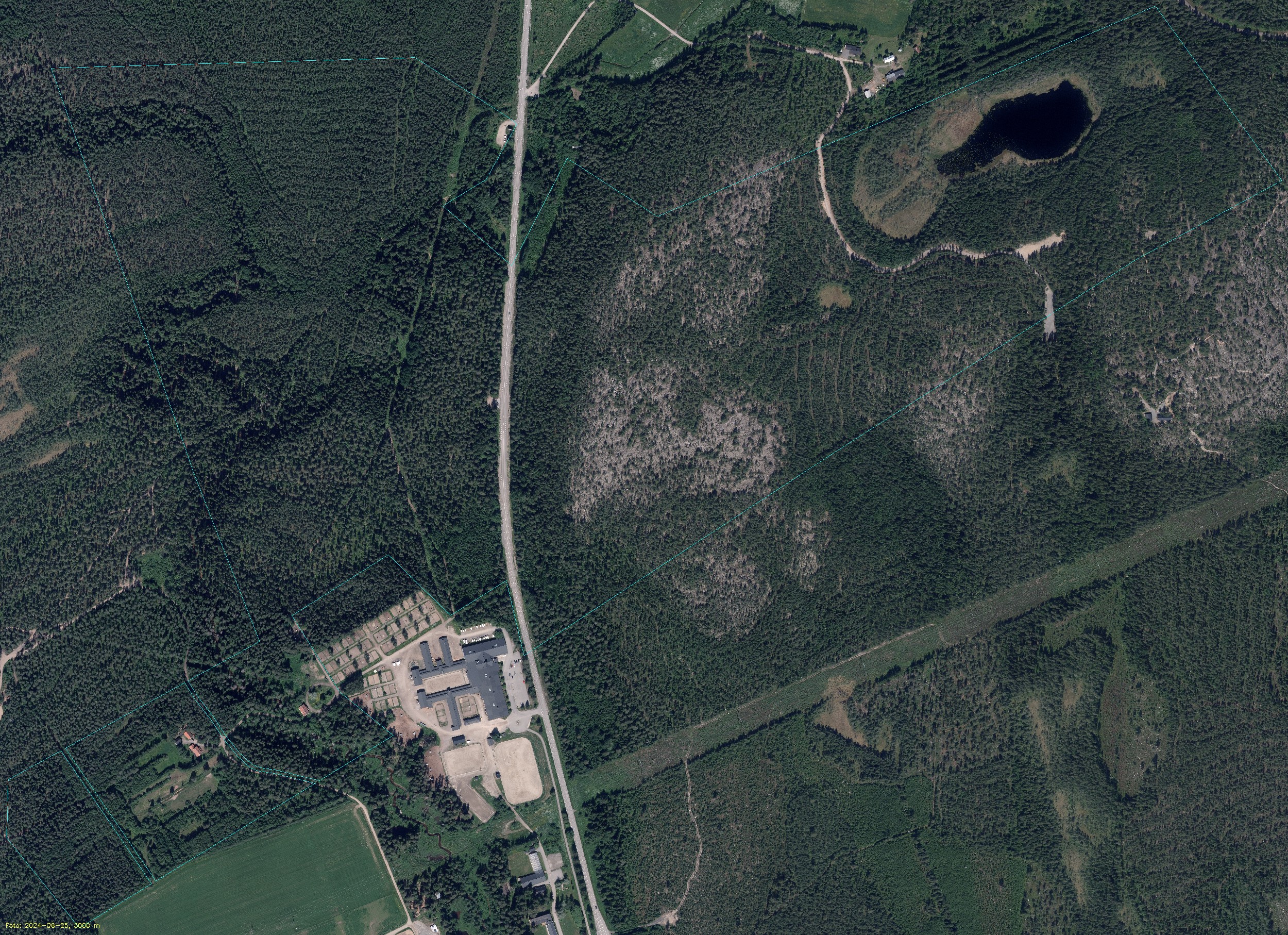
Get a list of all high-resolution orthophotos for each year. We will automatically mark
the property areas and their boundary and enhance image quality for displaying directly in a web application.
The response will include the open URL or reduced image URL to the high resolution image which you can directly reference.
Please note that typical response times are 50-100 ms per image for areas up to ~100 000 m2 so make sure your request doesn’t time out since a response could contain
up to 10 years of high-resolutions images (expect 1-3 seconds of non cached images).
Response will include a URL, url, representing loseless PNG which can be expected to be significant of size for large areas. We also
include a reduced version, urlReduced, in JPEG format (compressed) and images exceeding 2500 px in width will be resized to 2500 px
to avoid very large image sizes.
We recommend using the urlReduced for small displays and only use the full loselsess PNG for situations where you may need
the full details. Also included is the file sizes in byte for fileNameLength (url) and fileNameReducedLength (urlReduced). These
can help to make simple checks if you want to display the PNG or the JPEG image.
Example
This example shows a retrieved image for the property, UMEÅ AMERIKA 1:1, having an area of 1 068 479 m² (large) and the image rendered represents urlReduced e.g a compressed version in JPEG format. File size is ~2.3MB since it has been reduced to maximum 2500px in width (2500 x 1814px). If you switch the URL extension to PNG (e.g https://storage.tic.io/909a6a85-299b-90ec-e040-ed8f66444c3f_2024_32098.png) you will get the full uncompressed and unmodified size of 12619 x 9156 px. The file size is now ~237MB.
Recommendations
Recommendation is to use an if-statement to check if the fileNameLength is less than 10000000 (10MB) and display the url and if it’s greater than 10000000 display the urlReduced.Authorizations
Path Parameters
The unique identifier for the property
Response
200 - application/json
OK